Details for Flight 1395627
| ModeS Hex Code | AC64CF |
|---|---|
| Registration | N898UA |
| Aircraft Type | Airbus A319 132 A319 |
| Category | Jet |
| Operator |
United Airlines UAL  |
| Callsign | UAL215 |
| First Seen | 2025-02-06 17:47:19 |
| First Altitude | 34975 ft |
| Last Seen | 2025-02-06 18:10:27 |
| Last Altitude | 32975 ft |
| Flight Status |
 Descending Descending |
| Number of Positions Reported | 255 |
| Possibly Landed At | |
| Published Route |
ICAO: KIAH–KLGA IATA: IAH–LGA Airports: George Bush Intercontinental Houston to La Guardia Places: Houston, United States to New York, United States |
| Tracking |
 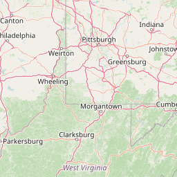   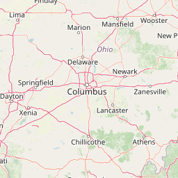 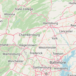   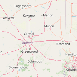 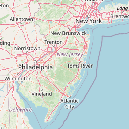   Leaflet © OpenStreetMap contributors |