Details for Flight 195094
| ModeS Hex Code | A3E610 |
|---|---|
| Registration | N350NY |
| Aircraft Type | King Air B350 B350 |
| Category | Biz Prop |
| Operator | New York Power Authority |
| Callsign | GRY2 |
| First Seen | 2024-05-23 23:49:42 |
| First Altitude | 2175 ft |
| Last Seen | 2024-05-24 00:14:58 |
| Last Altitude | 21000 ft |
| Flight Status |
 Climbing Climbing |
| Number of Positions Reported | 1987 |
| Possibly Landed At | |
| Published Route | |
| Tracking |
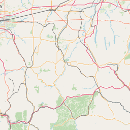   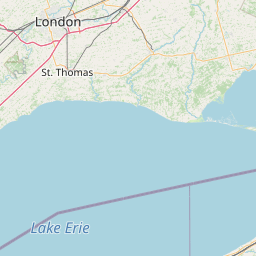    Leaflet © OpenStreetMap contributors |