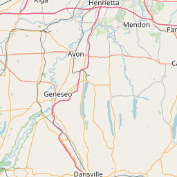
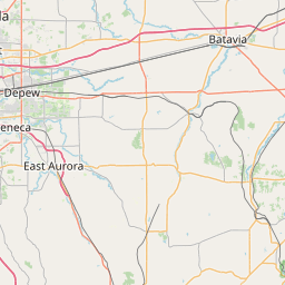
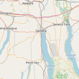
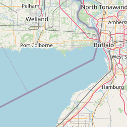
Details for Flight 892131
| ModeS Hex Code | A3E610 |
|---|---|
| Registration | N350NY |
| Aircraft Type | Hawker Beechcraft Corp King Air B350 B350 |
| Category | Biz Prop |
| Operator | New York Power Authority |
| Callsign | GRY2 |
| First Seen | 2024-10-10 18:38:13 |
| First Altitude | 1825 ft |
| Last Seen | 2024-10-10 19:04:30 |
| Last Altitude | 16775 ft |
| Flight Status |
 Climbing Climbing |
| Number of Positions Reported | 1546 |
| Possibly Landed At | |
| Published Route | |
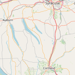
| Tracking |
Leaflet © OpenStreetMap contributors |