Details for Flight 928437
| ModeS Hex Code | A14FE0 |
|---|---|
| Registration | N184DN |
| Aircraft Type | 767 332ER/W B763 |
| Category | Jet |
| Operator |
Delta Air Lines DAL  |
| Callsign | DAL310 |
| First Seen | 2024-10-18 05:44:47 |
| First Altitude | 3850 ft |
| Last Seen | 2024-10-18 05:47:12 |
| Last Altitude | 2325 ft |
| Flight Status |
 Descending Descending |
| Number of Positions Reported | 159 |
| Possibly Landed At | |
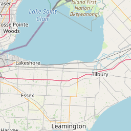
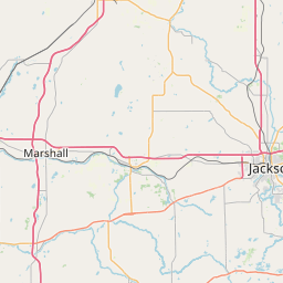
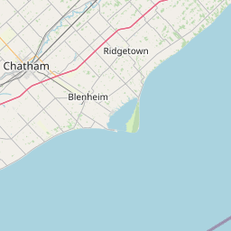
| Published Route |
ICAO: PHNL–KDTW IATA: HNL–DTW Airports: Honolulu to Detroit Metropolitan Wayne County Places: Honolulu, United States to Detroit, United States |
| Tracking |
Leaflet © OpenStreetMap contributors |