Details for Flight 99993070315
| ModeS Hex Code | A4E410 |
|---|---|
| Registration | N414MA |
| Aircraft Type | 414A Chancellor C414 |
| Category | General Aviation |
| Operator | Private |
| Callsign | |
| First Seen | 2016-07-14 05:49:49 |
| First Altitude | 17150 ft |
| Last Seen | 2016-07-14 06:31:05 |
| Last Altitude | 17100 ft |
| Flight Status |
 Level flight Level flight |
| Number of Positions Reported | 1661 |
| Possibly Landed At | |
| Published Route | |
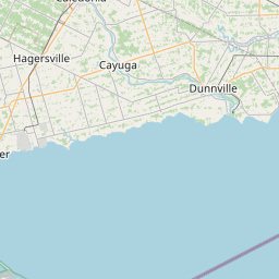
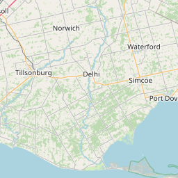
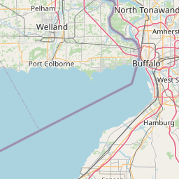
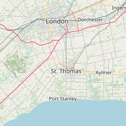
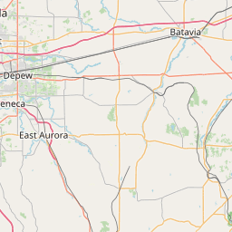
| Tracking |
Leaflet © OpenStreetMap contributors |