Details for Flight 9999482016
| ModeS Hex Code | AC9E26 |
|---|---|
| Registration | N912AN |
| Aircraft Type | 737NG 823/W B738 |
| Category | Jet |
| Operator |
American Airlines AAL  |
| Callsign | AAL584 |
| First Seen | 2019-08-22 04:32:12 |
| First Altitude | 37000 ft |
| Last Seen | 2019-08-22 04:36:05 |
| Last Altitude | 37000 ft |
| Flight Status |
 Level flight Level flight |
| Number of Positions Reported | 69 |
| Possibly Landed At | |
| Published Route |
ICAO: KPHX–KBWI IATA: PHX–BWI Airports: Phoenix Sky Harbor to Baltimore/Washington International Thurgood Marshal Places: Phoenix, United States to Baltimore, United States |
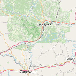
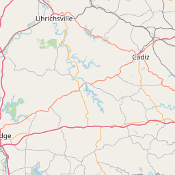
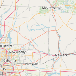
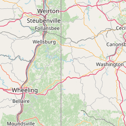
| Tracking |
Leaflet © OpenStreetMap contributors |