Details for Flight 99996803808
| ModeS Hex Code | A94B29 |
|---|---|
| Registration | N69824 |
| Aircraft Type | 737NG 924ER/W B739 |
| Category | Jet |
| Operator |
United Airlines UAL |
| Callsign | UAL717 |
| First Seen | 2018-10-17 18:20:52 |
| First Altitude | 24000 ft |
| Last Seen | 2018-10-17 19:08:04 |
| Last Altitude | 26000 ft |
| Flight Status |
 Climbing Climbing |
| Number of Positions Reported | 3927 |
| Possibly Landed At | |
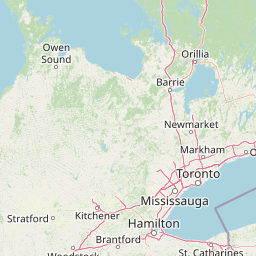
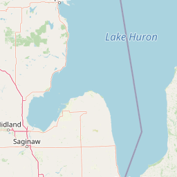
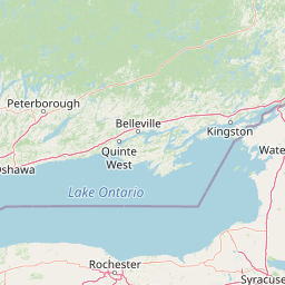
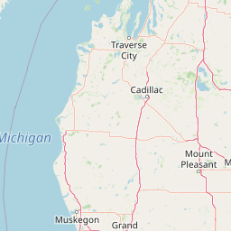
| Published Route |
ICAO: KBOS–KIAH IATA: BOS–IAH Airports: General Edward Lawrence Logan to George Bush Intercontinental Houston Places: Boston, United States to Houston, United States |
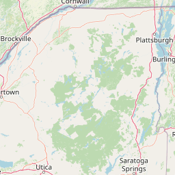
| Tracking |
Leaflet © OpenStreetMap contributors |