Details for Flight 99997468965
| ModeS Hex Code | A482FC |
|---|---|
| Registration | N390CA |
| Aircraft Type | CRJ 700 CRJ7 |
| Category | Jet |
| Operator |
Delta Connection ASQ  |
| Callsign | GJS6187 |
| First Seen | 2019-03-18 07:02:23 |
| First Altitude | 38000 ft |
| Last Seen | 2019-03-18 07:10:31 |
| Last Altitude | 38000 ft |
| Flight Status |
 Level flight Level flight |
| Number of Positions Reported | 156 |
| Possibly Landed At | |
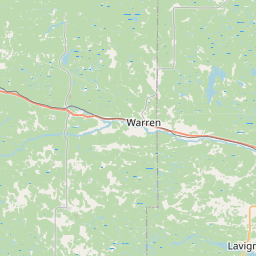
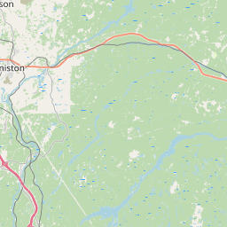
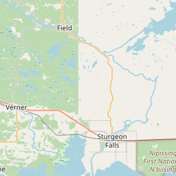
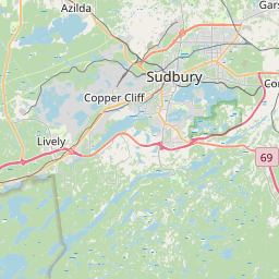
| Published Route |
ICAO: KSTL–KDTW IATA: STL–DTW Airports: Lambert St Louis to Detroit Metropolitan Wayne County Places: St Louis, United States to Detroit, United States |
| Tracking |
Leaflet © OpenStreetMap contributors |